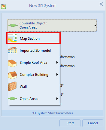
Map Section
If a new project is planned with the 3D visualization a true-to-scale map section can be selected as the allocation area for the 3D objects. This makes it possible, for example, to realistically reflect the distances to shading objects. Some map providers use digital orthophotos (DOP) in their maps, which, among other things, are distortion-free and gable-symmetrical and are therefore particularly suitable for planning.The list of available map providers is updated at regular intervals.
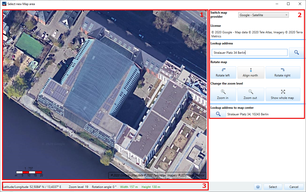
Selection of a map section for 3D planning
Select a map section as occupancy object
After selecting Map Section from the drop-down menu, the window expands in a way that, among other things, a map symbol becomes visible in the top right corner. Clicking this symbol opens the window for selecting a new map section.
Page: 3D Design
The window is divided into 3 areas::
- Area 1 the map of the selected map provider is shown together with a scale bar and a license text
- Area 2 shows control elements with which the map view can be edited
- Section 3 shows information about the current selected map section
The map
The displayed section of the map can be changed using the mouse. To do so, the mouse must focus the map. Via the mouse wheel the map section can be zoomed in or out. The map can be moved by pressing and holding the right mouse button and dragging it opposite to the desired direction.
The scale bar consists of a numeric scale and a bar which allows a approximate length measurement. Depending on the zoom level, the unit is either meters or kilometers. If the map scale changes due to a zoom action, also the scale gets updated.
Edit map view
Switch map provider
In a drop-down menu you can switch between different map providers. It should be noted that different card providers may cover different parts of the world. For example, if you change from a larger into a smaller map and the previously displayed map section is outside the displayable area of the new map provider, the map shows the whole area of the selected provider.
The default map provider is Google Satellite.
Information about the resolution of some map provider:
- Denmark: DOP20
- Berlin-Brandenburg: DOP20
- North Rhine-Westphalia: DOP20
Lookup adress
In the text box you can enter the address of the plant location with postal code, city and street name.A click on
 or pressing Enter starts the search.
If a result is found, the viewport of the map shifts to this new position. If the case should occur that the requested address is outside the displayable range of the respective map provider, the position does not change. A message is displayed via an info box.
or pressing Enter starts the search.
If a result is found, the viewport of the map shifts to this new position. If the case should occur that the requested address is outside the displayable range of the respective map provider, the position does not change. A message is displayed via an info box.
Rotate the map
The card can be rotated counter-clockwise or clockwise in 5° intervals. This makes it possible to align the target object to a straight edge. By default, all maps are oriented to true north.If the map has been rotated, it can be oriented north again by clicking on Align North.
Change the zoom level
The zoom level can be changed not only with the mouse wheel but also with the buttons Zoom in and Zoom out. The button Show the whole map zooms to the point where the map is visible in its full size.
Lookup address to map center
If the button
is pressed, the address to the map center will be located. The level of detail of the determined address depends on the zoom level.
Select the map section in such a way that near shading objects are included, but the target object is still visible in a sufficient resolution.
Information about the map section
This area contains:
- the current latitude and longitude under the cursor,
- the zoom level,
- the rotation angle,
- and the length and width of the current viewport.
- If one of the two value pairs appears in red, its indicating that the current map section is too large to be used as a basis for 3D planning. As soon as both are displayed in green, the section can be used. Both values have to be less or equal than 800m.
Select map section
The button
 closes the map tool. Though it transfers the current map section together with the scale and rotation angle to the 3D Visualization tool.
It is only possible to select map sections whose height and width are less than 800 meters. The Selection button is only enabled if this is the case.