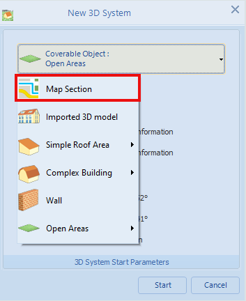
Map Section
If a new project is planned with the 3D visualisation, a true-to-scale map section can be selected as the occupancy area for the 3D objects. This makes it possible, for example, to faithfully reproduce the distances to shading objects. Some map providers use digital orthophotos (DOP) in their maps, which, among other things, are distortion-free and gable-symmetrical and are therefore particularly suitable for planning.
The list of available map providers is updated at regular intervals.
General
The search field is focussed using the key combination CTRL + F. This allows you to search directly for a new address.
This search field also accepts the ENTER key to start a search.
The group boxes around the control elements can be minimised. The group boxes for the zoom and rotation functions are minimised by default.
Selection of a map section for 3D planning
Select a map section as occupancy object
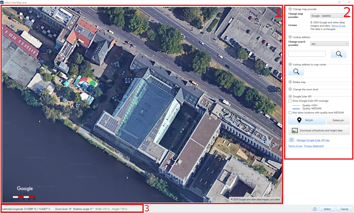
After selecting Map Section from the drop-down menu, the window expands in a way that, among other things, a map symbol becomes visible in the top right corner. Clicking this symbol opens the window for selecting a new map section.
Page: 3D Design
The window is divided into 3 areas::
- Area 1 the map of the selected map provider is shown together with a scale bar and a license text
- Area 2 shows control elements with which the map view can be edited
- Section 3 shows information about the current selected map section
The map
The displayed section of the map can be changed using the mouse. To do this, the mouse must be in the centre of the map section. The map section can be enlarged or reduced using the mouse wheel. The map can be moved with the left mouse button.
The mouse button must remain pressed while dragging. For a rough estimate of the length, there is a scale bar at the bottom left of the map section. If the map scale changes due to a zoom action, also the scale gets updated. The scale bar consists of a numeric scale and a bar which allows a approximate length measurement. Depending on the zoom level, the unit is either meters or kilometers.
Control the map using the operating elements
Switch card provider
In a drop-down menu you can switch between different map providers. It should be noted that different card providers may cover different parts of the world. If the new map provider covers the current map section, only the map material is replaced. The position of the map does not change. However, if the new map does not include this, the system zooms to the overall view of the new map provider.
This may result in only a white section of the map being displayed after a change. This can occur, for example, when switching from the map of Schleswig-Holstein to the map of Denmark, or between the individual federal states of Austria. This occurs because the extent of the maps mathematically covers more area, but this is not displayed. This can give the impression that the card is empty when changing. This can be remedied by zooming in on the overall view.
The default map provider is Google Satellite.
Details for the map providers:
| Provider | Resolution1 | Time of recording2 | Type |
|---|---|---|---|
| Austria | |||
| Austria - Burgenland | |||
| Austria - Carinthia | |||
| Austria - Tyrol | |||
| Austria - Vienna city area | 0.15 | July 2023 | DOP |
| Belgium | |||
| Belgium - Brussels Region | 2023 | ||
| Denmark | 0.2 | 2023 | DOP |
| Germany - Bavaria | |||
| Germany - Brandenburg/Berlin | 0.2 | 2020 | TrueDOP |
| Germany - North Rhine-Westphalia | 0.1 | 2020 | DOP |
| Germany - Schleswig-Holstein | DOP20 | ||
| Italy - North Tyrol | 0.6 | 2021 | DOP |
| Switzerland | 10 | 2005 | DOP |
The map of Austria shows the entire country, but the map ‘Austria Carinthia’ has a better resolution for some areas.
Lookup adress
A search provider can be selected. This is used for both forward and reverse searches. The most common providers were integrated. The list is managed on a server and can therefore be changed without updating PV*SOL.
The pseudo provider any is selected by default. This selection leads to our server deciding which search provider to use. The provider used is appended to each search result in italics with a hyphen. This option is recommended if the search provider is not important to you.
You can enter the address of the system location with postcode, city and street name in the text field.
The search is started by clicking on
 or pressing the
 ENTER key.
If only one result is found, the map section changes directly to this new position. the address is entered in the search results field. If there is more than one search result, the position of the map only changes when a search result is selected.
The quality, number of search results and the zoom level per search result can vary greatly between individual search providers.
If there is no result for the query, changing the search provider could help, or using the any pseudo provider.
If the address you are looking for is outside the displayable area of the respective map provider, the position will not change. A message is displayed in an info box.
This list can also change without a version update of PV*SOL. Some search providers could be removed or replaced in this way. But new ones can also be added.
The search results can be displayed in the programme language set in PV*SOL. However, only some search providers support this translation.
Lookup address to map center
If the button
is pressed, the address to the map center will be located.
The previously selected search provider from the Search address item is used for the search.
Some search providers generate a search result for this ‘reverse search’ depending on the zoom level, e.g. Nominatim. Others only ever return one search result.
Rotate the map
The card can be rotated counter-clockwise or clockwise in 5° intervals. This makes it possible to align the target object to a straight edge. By default, all maps are oriented to true north. If the map has been rotated, it can be oriented north again by clicking on Align North.
Change the zoom level
The zoom level can be changed not only with the mouse wheel but also with the buttons Zoom in and Zoom out. The button Show the whole map zooms to the point where the map is visible in its full size.
Google Solar API
The description of these functions can be found on a separate help page: Google Solar API.
Information on the map section
This bar contains information about the map section:
- A display of the longitude and latitude
- The current zoom level
- The rotation angle of the map
- The longitude and latitude of the map section.
- If one of the two pairs of values appears in red text colour, this means that the current map section is too large to be used as a basis for 3D planning. As soon as both are displayed in green, the section can be used. Both values must be less than 800m.
There are several ways to determine the covered length and height of the displayed map section. The two values ‘width’ and ‘height’ provide a more precise estimate. These show the distance of the map width and height of the visible map section.
Select map section
The button
 closes the map tool.
Though it transfers the current map section together with the scale and rotation angle to the 3D Visualization tool.
closes the map tool.
Though it transfers the current map section together with the scale and rotation angle to the 3D Visualization tool.
Select the map section in such a way that near shading objects are included, but the target object is still visible in a sufficient resolution.
It is only possible to select map sections whose height and width are less than 800 meters. The Selection button is only enabled if this is the case.
Further Information
See also